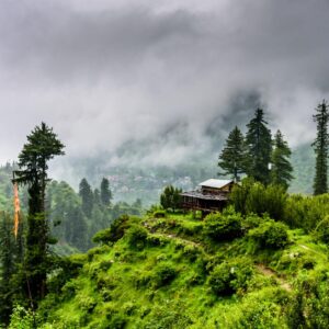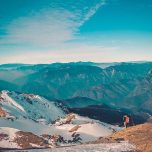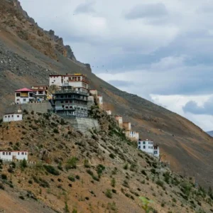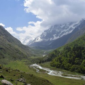
Most people who visit Ladakh say it changes something in them. Not in a dramatic way in the quiet way that happens when you spend time somewhere so different from your everyday life that you stop comparing it to anything else. The landscape here is unlike any other part of India. Brown and grey mountains that look carved rather than grown.
Whether you are planning a Ladakh tour package through Trip Guru Go or doing your own research, this guide covers 22 places to visit in Ladakh with detailed practical information for every stop. In this blog, you will know about the best destinations across Leh, Nubra Valley, the lake circuit, the monastery trail, and the offbeat spots that most travellers miss.
Quick Overview: Ladakh at a Glance
| Category | Details |
| Location | Union Territory of Ladakh, northern India |
| Famous For | High-altitude lakes, mountain passes, Buddhist monasteries, snow leopard, biking |
| Best Time to Visit | June to September (summer); January to February (Chadar Trek) |
| Ideal Trip Duration | 7 to 12 days |
| Nearest Airport | Kushok Bakula Rimpochee Airport, Leh |
| Average Altitude | 3,500 metres (Leh); up to 5,359 m at passes |
| Best For | Bikers, trekkers, couples, solo travellers, wildlife enthusiasts, photographers |
Ladakh Trip – Explore the Land of High Passes
 Group Trip
Srinagar to Leh with Hanle, Umling La & Tso Moriri
 Group Trip
Manali Leh Circuit with Nubra, Turtuk, Pangong, Hanle & Umling La
 Group Trip
04 Apr 2027 (+6 dates)
Group Trip
04 Apr 2027 (+6 dates)
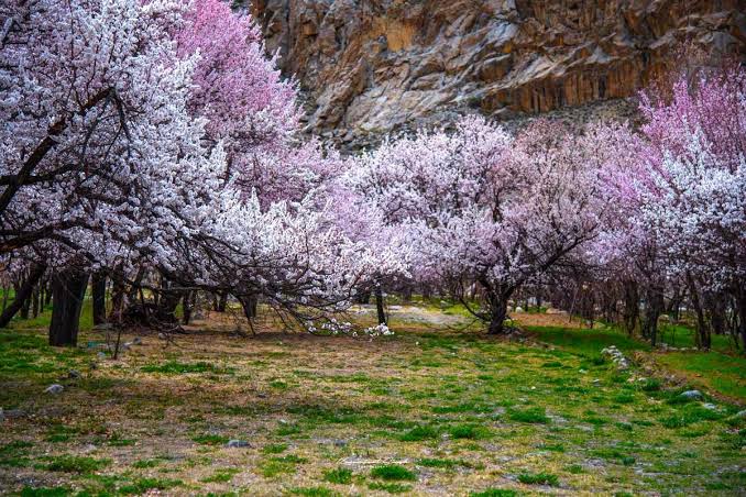
Leh Ladakh Apricot Blossom Special
 Group Trip
Leh, Nubra, Turtuk, Pangong, Hanle & Umling La
Best Time to Visit Ladakh
Ladakh is one of those destinations where the season you visit completely changes the experience. The landscape, the activities available, and the accessibility all vary dramatically across the year.
| Season | Months / What to Expect |
| Summer | June to September. The most popular and accessible season. All passes open, Pangong and Tso Moriri accessible. Day temperatures 15–25°C in Leh, nights drop to 5–10°C |
| Autumn | October to November. Clear skies, dramatic light, fewer tourists. Some passes close by late October. Nights become cold quickly. Excellent for photography |
| Winter | December to February. Extremely cold (-15°C to -30°C in most areas). Chadar Trek on the frozen Zanskar River. Roads via Manali are closed. Srinagar-Leh route may remain partially open |
| Spring | March to May. Temperatures rise slowly. The Manali route usually opens in late May. Good for visiting Leh city, monasteries, and lower-altitude sites. Passes still closed in March-April |
Best Places to Visit in Ladakh
From iconic lakes and world-record mountain passes to rarely visited village monasteries and cold desert wildlife sanctuaries, these 22 destinations cover everything that makes Ladakh worth travelling to.
1. Leh City
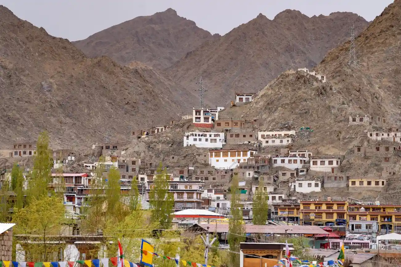
Leh is the capital of the Ladakh Union Territory and the entry point for almost every visitor. Sitting at 3,524 metres along the Indus River, the city mixes the old and the new in a way that does not feel jarring. Most travellers reach Leh from Delhi by a short flight or one of the two classic highway routes, then use the city as their base before heading further into the region. The old town has narrow lanes, whitewashed houses, Tibetan-style architecture, and the 17th-century Leh Palace watching over everything from a ridge. The main bazaar is lively and practical.
This is where you buy supplies, withdraw cash, arrange permits, hire vehicles, and eat well before heading deeper into the region. Leh also has several important sites within walking distance of the main market: Shanti Stupa, the Namgyal Tsemo Monastery, the Jama Masjid, and the Hall of Fame war memorial. Most travellers spend two to three days in Leh acclimatising before the altitude allows them to attempt higher destinations.
| Detail | Information |
| Location | Leh district, on the banks of the Indus River |
| Altitude | 3,524 metres |
| Distance from Delhi | 1,000 km by road; 1 hour 20 minutes by flight |
| Entry Fee | Leh Palace: ₹25 (Indians); Hall of Fame: ₹50 |
| Leh Palace Timings | 7:00 AM to 4:00 PM (closed Mondays) |
| Best Time to Visit | June to October; March to May for quieter experience |
| Temperature Range | -14°C to 27°C |
| How to Reach | Direct flights from Delhi, Mumbai, Chandigarh; road via Manali (480 km) or Srinagar (434 km) |
| Best For | All travellers; essential acclimatisation stop |
Travel Tip: Spend at least two full days in Leh before heading to higher-altitude destinations like Khardung La, Pangong, or Tso Moriri. This acclimatisation significantly reduces the risk of altitude sickness.
Safety Tip: Avoid alcohol and strenuous activity on your first two days in Leh. Drink water consistently, eat light meals, and get to bed early. Altitude sickness is the single biggest health risk in Ladakh.
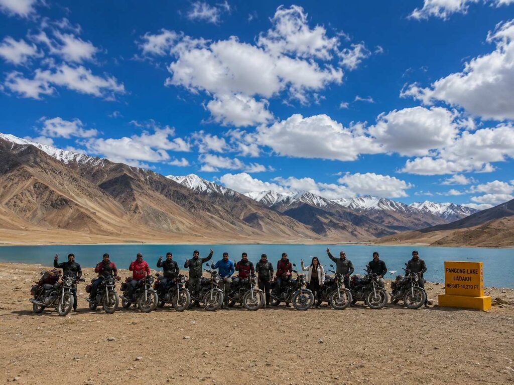
2. Pangong Tso (Pangong Lake)
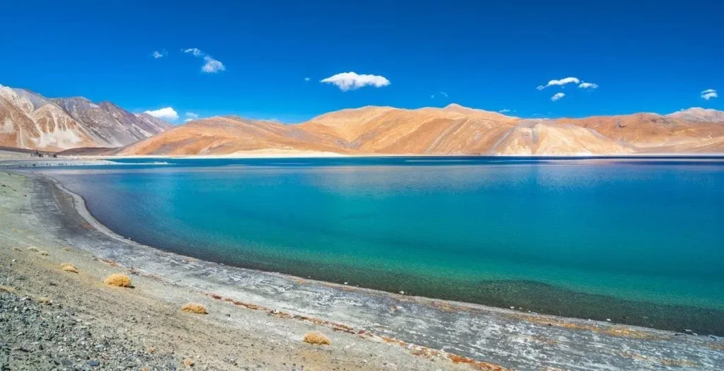
Pangong Tso is at 4,350 metres and extends about 134 kilometres from Ladakh into Tibet, with roughly 60 kilometres of the lake falling within Indian territory. The water colour changes from deep blue to turquoise to green depending on the time of day, cloud cover, and season. In winter, the lake freezes completely and the ice surface reflects the surrounding peaks in a way that looks completely unreal. The drive from Leh is about 150 kilometres via Chang La Pass (5,360 m) and takes around five hours.
The lake became widely known across India after the 2009 film 3 Idiots was shot here. Since then, tourist numbers have grown significantly and the government has removed all permanent tourist facilities from the lakeside to protect the ecosystem. Camping in designated areas is permitted and the experience of spending a night at the lake particularly at sunrise is one of the most widely described experiences in all of Ladakh.
| Detail | Information |
| Location | Chang Chenmo valley, 150 km from Leh |
| Altitude | 4,350 metres |
| Length | 134 km (60 km in India) |
| Entry Fee | ₹100 per person (additional camera fee for some zones) |
| Timings | Open all day; camping regulated in designated areas |
| Best Time to Visit | June to September; January for frozen lake |
| Temperature Range | -30°C to 15°C |
| How to Reach | Road from Leh via Chang La Pass (5 hours); permits required |
| Best For | Couples, photographers, nature lovers, all travellers |
Travel Tip: Arrive at Pangong before 8 AM if you want the lake to yourself. The surface is completely still in the early morning and the reflection of the mountains on the water is clearest before 9 AM.
Safety Tip: Chang La Pass is at 5,360 metres. Do not attempt the drive if you are still experiencing any altitude symptoms in Leh. The descent to the lake provides some relief but the pass itself is challenging.
3. Nubra Valley
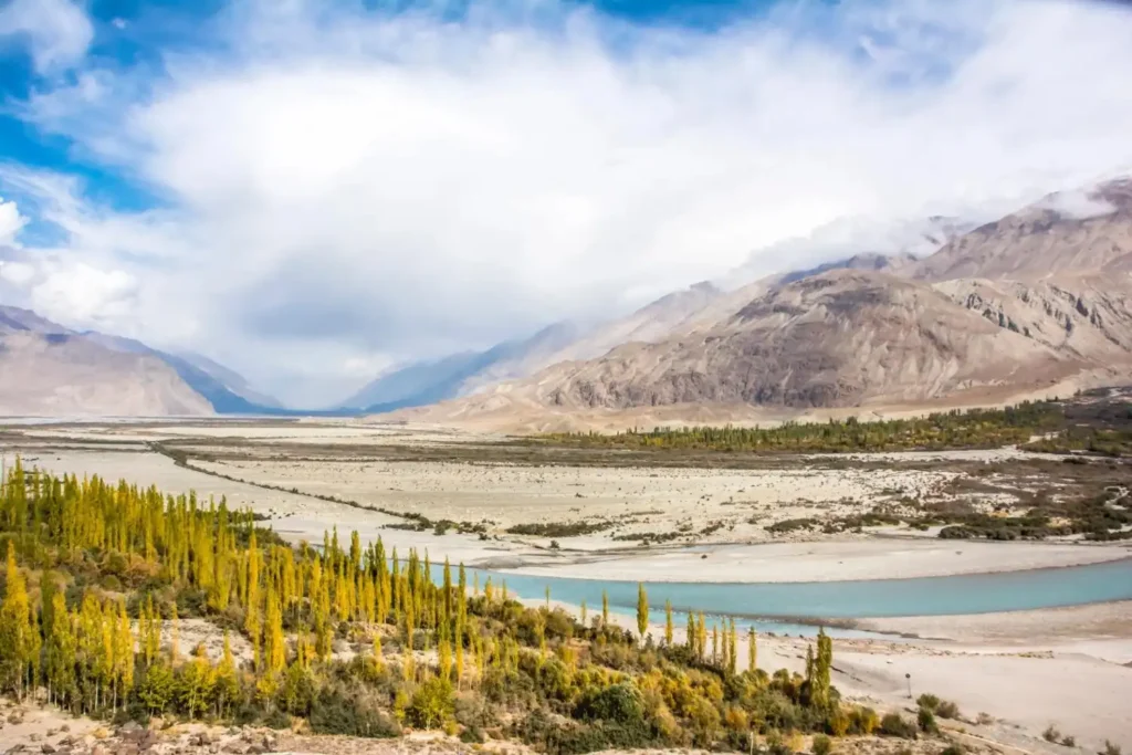
Nubra Valley lies north of Leh beyond Khardung La Pass, in the meeting point of the Shyok and Nubra rivers. The valley has a cold desert character dunes of sand running between rows of poplar trees, with snow peaks rising on both sides. The most famous activity here is the Bactrian camel ride at Hunder village, where the double-humped camels (originally used on the Silk Route) walk tourists across the sand dunes.
Nubra has several important sites: the Diskit Monastery (600 years old with a 32-metre Maitreya Buddha statue), the sand dunes at Hunder, the hot springs at Panamik, and the village of Turtuk near the Pakistan border. Most travellers stay overnight in Nubra, either at a camp in Hunder or a guesthouse in Diskit, before returning to Leh or continuing to Pangong via the direct Shyok Valley road.
| Detail | Information |
| Location | North of Leh, accessed via Khardung La Pass |
| Altitude | 3,000 to 3,500 metres (valley floor) |
| Distance from Leh | 120 km via Khardung La |
| Entry Fee | Permit required (obtained in Leh); Diskit Monastery: ₹30 |
| Best Time to Visit | June to September |
| Temperature Range | -20°C to 28°C |
| How to Reach | Road from Leh via Khardung La (4–5 hours); Inner Line Permit required |
| Best For | Families, couples, adventure travellers, photographers |
Travel Tip: The Hunder to Pangong direct road via Shyok Valley (Wari La) is a beautiful alternative to returning via Khardung La. It adds roughly 2 hours but passes through some of the least-visited terrain in Ladakh.
Safety Tip: Inner Line Permits for Nubra Valley must be obtained before departure. These can be done online via the official Ladakh Tourism website or at the DC Office in Leh. Foreign nationals need additional documentation.
4. Khardung La Pass
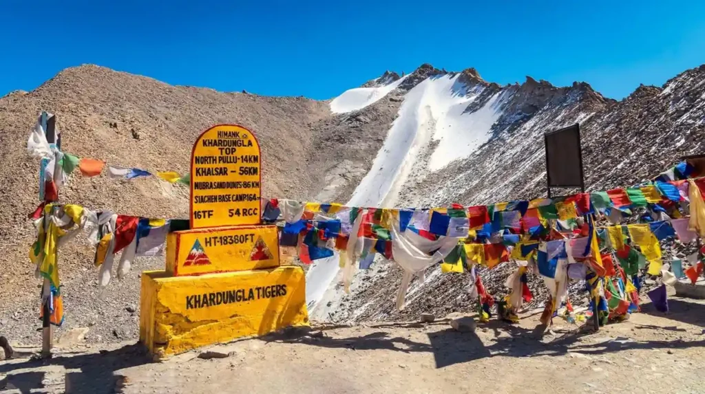
Khardung La at 5,359 metres is one of the highest motorable mountain passes in the world and the main gateway to the Nubra Valley from Leh. The road from Leh to the pass takes about 1.5 to 2 hours and crosses through progressively colder and more barren terrain until the pass itself a windswept ridge with prayer flags, a small army post, a soup stall, and views in all directions of the Ladakh Range. The pass is open for most of the year but conditions can deteriorate rapidly in bad weather. The Khardung La Café at the summit, maintained by the army, serves tea, soup, and simple food to travellers. This is a compulsory stop for most Ladakh road trips and one of the most photographed locations in the region.
| Detail | Information |
| Location | On the road between Leh and Nubra Valley |
| Altitude | 5,359 metres |
| Distance from Leh | 40 km |
| Entry Fee | No fee; permit for Nubra required (obtained in Leh) |
| Open Season | Most of the year; occasional closures in heavy snow |
| Best Time to Visit | June to October |
| Temperature Range | -35°C to 5°C |
| How to Reach | Road from Leh via South Pullu checkpost |
| Best For | Bikers, adventure road trip travellers, photographers |
Travel Tip: Do not spend more than 20–30 minutes at the top. At 5,359 metres, extended time at the pass can trigger altitude sickness even in acclimatised travellers. Take your photos, have a hot drink, and continue.
Safety Tip: The road down from Khardung La toward Nubra has some exposed sections with steep drops and no barriers. Drive at low speed. In winter or after rain, the road surface becomes icy and dangerous.
5. Thiksey Monastery
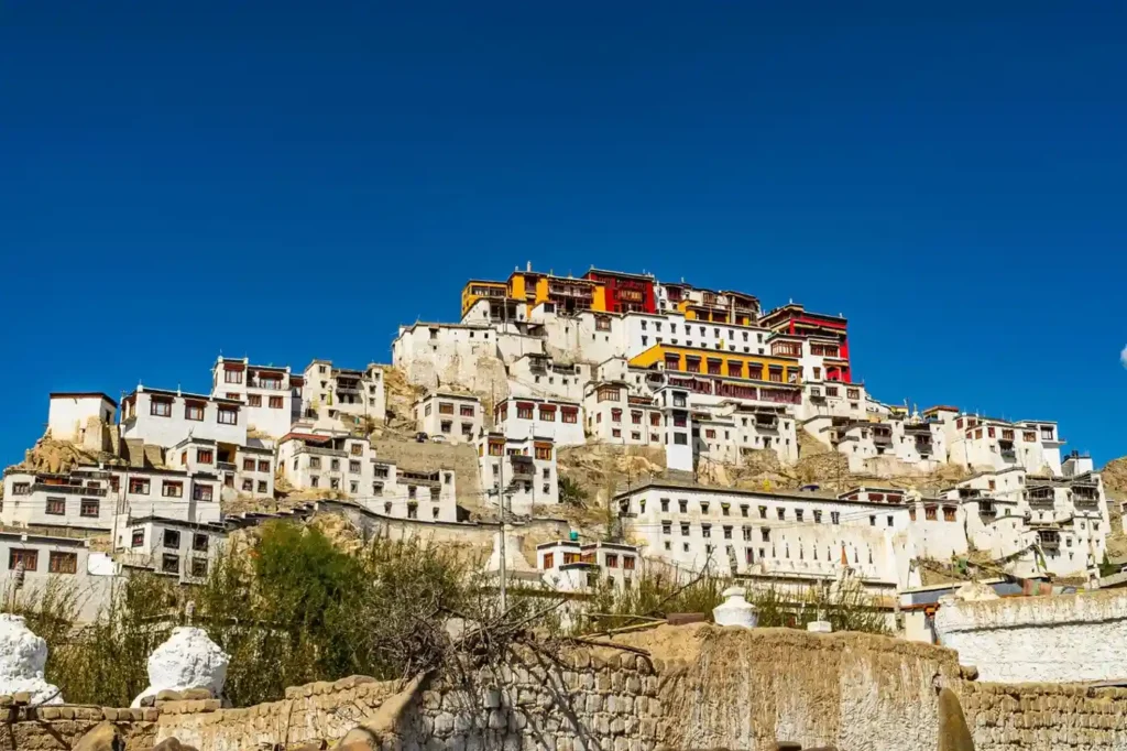
Thiksey Monastery sits at 3,600 metres on a hilltop about 19 kilometres from Leh and is one of the most visually impressive structures in all of Ladakh. The 12-storey complex rises from the hilltop in a cascade of whitewashed walls, red-trimmed windows, and golden rooftop elements that genuinely resembles the Potala Palace in Lhasa, Tibet.
The monastery belongs to the Gelug sect of Tibetan Buddhism and houses around 500 monks. The main prayer hall contains a 15-metre-high Maitreya Buddha statue (built in 1970) that is one of the largest such statues in the region. The morning prayer session at 6 AM, with all the monks in attendance, is widely considered one of the best monastic experiences in Ladakh. The monastery also holds the Gustor festival annually in October or November.
| Detail | Information |
| Location | 19 km from Leh, on the Leh-Manali highway |
| Altitude | 3,600 metres |
| Entry Fee | ₹50 per person |
| Timings | 7:00 AM to 5:00 PM |
| Morning Prayer | 6:00 AM (visitors welcome) |
| Best Time to Visit | June to October; October-November for Gustor festival |
| Temperature Range | -15°C to 25°C |
| How to Reach | Shared taxi or private vehicle from Leh (30 minutes) |
| Best For | All travellers; cultural enthusiasts, photographers, families |
Travel Tip: Combine Thiksey with Shey Monastery and Hemis Monastery in a single full-day excursion from Leh. All three are within 25 kilometres of each other on the same road.
Safety Tip: The stairways inside Thiksey are steep and uneven. Wear shoes with grip and hold the handrails on the upper floors where the architecture narrows.
6. Hemis Monastery and Hemis National Park
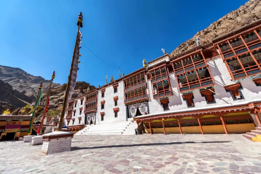
Hemis Monastery is 45 kilometres from Leh and is the largest and wealthiest Buddhist monastery in Ladakh. Founded in the 11th century and rebuilt in the 17th century by King Sengge Nampar Gyalwa, Hemis belongs to the Drukpa Kagyu lineage of Tibetan Buddhism. The monastery is known for its vast thangka collection, one of the most significant in the world and the annual Hemis Festival held in June or July, which features large ceremonial Cham dances and the display of the giant thangka.
Adjacent to the monastery is Hemis National Park, covering 4,400 square kilometres, which is South Asia’s largest national park. The park is home to an estimated 200 snow leopards one of the highest densities in the world along with Himalayan wolf, brown bear, ibex, bharal (blue sheep), and over 70 bird species.
| Detail | Information |
| Location | 45 km from Leh, in the Indus Valley |
| Altitude | 3,700 metres (monastery); up to 6,000 m in the park |
| Monastery Entry Fee | ₹50 per person |
| Park Entry Fee | ₹25 per Indian national per day |
| Timings | Monastery: 8:00 AM to 6:00 PM |
| Best Time for Snow Leopard | December to March |
| Best Time for Festival | June or July (Hemis Tshechu, Tibetan lunar calendar) |
| How to Reach | Road from Leh (1 hour); shared taxi available |
| Best For | Wildlife enthusiasts, photographers, cultural travellers |
Travel Tip: For snow leopard sightings, book a guided wildlife trek from the park entry point. Local naturalist guides have better knowledge of movement patterns than guides from Leh city.
Safety Tip: Trekking inside Hemis National Park requires a permit and is best done with a registered guide. Solo trekking in the interior sections is not recommended due to difficult terrain and limited phone coverage.
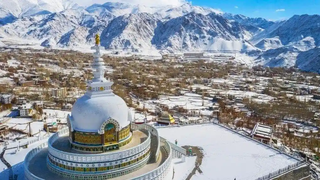
7. Shanti Stupa
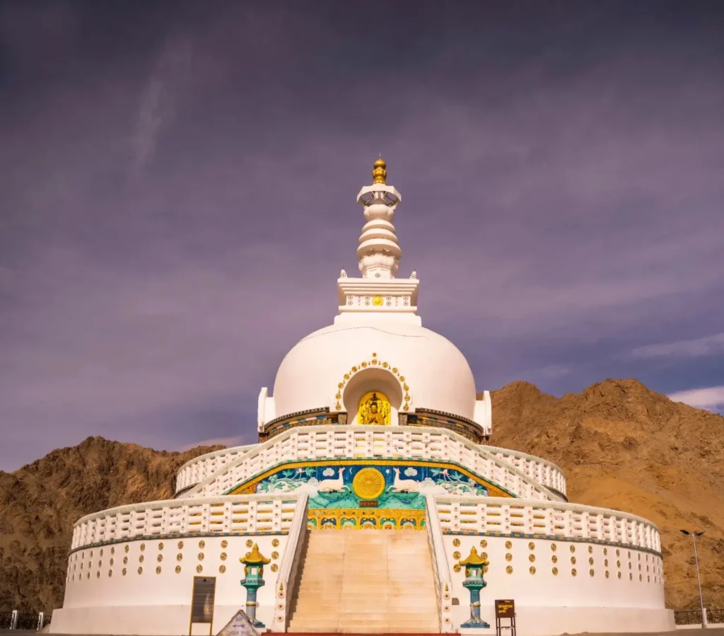
Shanti Stupa is a white Buddhist monument on a hilltop at 3,620 metres, about 5 kilometres from the Leh main market. It was built in 1985 by Japanese Buddhist monk Gyomyo Nakamura in cooperation with Indian and Japanese Buddhist organisations, as part of a global series of peace stupas. The stupa houses relics of the Buddha at its base and at the top level.
It offers a 360-degree view of the Leh valley, the Zanskar Range to the south, the Ladakh Range to the north, and the Stok Kangri peak (6,153 m) across the valley. Most visitors reach the stupa by climbing 500 steps from the road below, or by taking the road around the back of the hill. Sunrise and sunset visits give the best light for photography of both the stupa and the surrounding landscape.
| Detail | Information |
| Location | Changspa area, 5 km from Leh main market |
| Altitude | 3,620 metres |
| Entry Fee | Free |
| Timings | 5:00 AM to 9:00 PM |
| Best Visit Time | Sunrise (6:00–7:30 AM) or sunset (6:30–8:00 PM in summer) |
| Temperature Range | -14°C to 27°C |
| How to Reach | 500 steps from the road or vehicle road via the back approach |
| Best For | All travellers; photographers, solo travellers, couples |
Travel Tip: The 500-step climb to Shanti Stupa should be done at a slow pace, especially in the first two days in Leh. Stop and rest every 50–100 steps if needed. The climb takes 20–25 minutes at a moderate pace.
Safety Tip: After dark, the path up the steps is unlit. Carry a torch or use your phone flashlight if visiting for sunset, as the return walk down in low light can be uneven on the stone steps.
8. Leh Palace
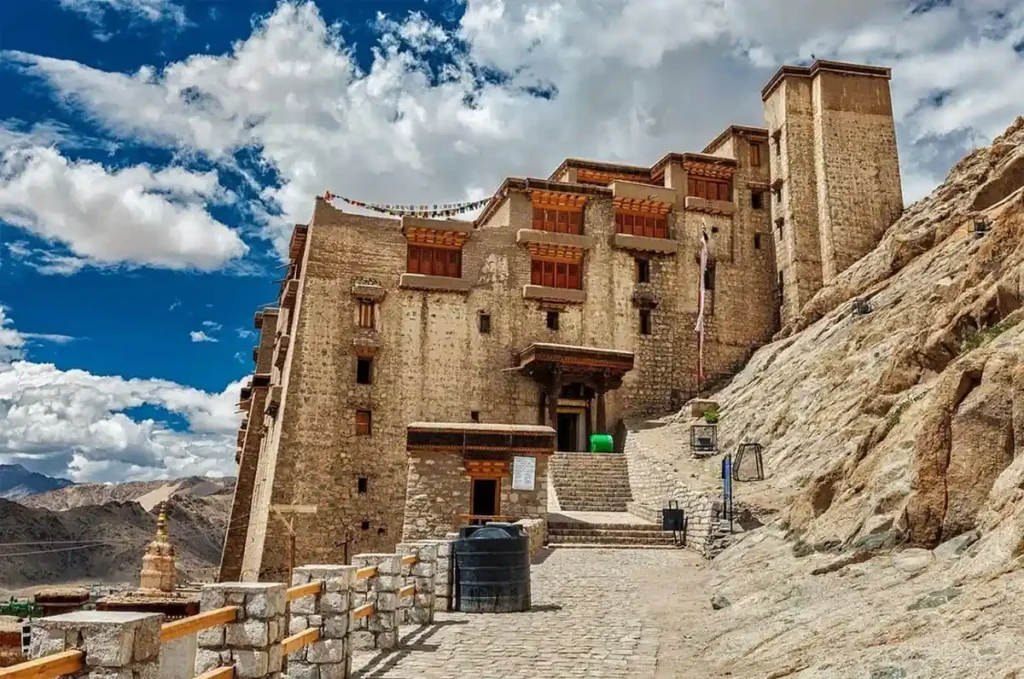
Leh Palace was built in the 17th century by King Sengge Nampar Gyalwa and served as the royal residence until the Ladakh royal family shifted to Stok Palace in the 19th century. The nine-storey structure is built directly into the cliff overlooking Leh town and modelled on the Potala Palace in Lhasa. The palace is now maintained by the Archaeological Survey of India and houses a museum with royal artefacts, old thangka paintings, and manuscripts.
The top floors offer the most impressive view of Leh city, the Indus Valley, and the surrounding mountain ranges. The palace sits immediately below the Namgyal Tsemo Monastery (a further 15-minute climb uphill), which has a 15-metre Maitreya Buddha and an important collection of scriptures and murals.
| Detail | Information |
| Location | Old Town, Leh, overlooking the main bazaar |
| Altitude | 3,524 metres |
| Entry Fee | ₹25 (Indians); ₹300 (foreign nationals) |
| Timings | 7:00 AM to 4:00 PM (closed Mondays) |
| Best Visit Time | Morning (7–9 AM) for the best light on the palace facade |
| Temperature Range | -14°C to 27°C |
| How to Reach | 20-minute walk uphill from the main bazaar through the old town lanes |
| Best For | History enthusiasts, architecture lovers, all travellers |
Travel Tip: Walk up through the old Leh town lanes rather than taking the vehicle road. The mud-brick houses, wooden balconies, and narrow alleys of the old quarter are themselves worth the detour.
Safety Tip: Several sections of the upper floors are in partial ruin. Stay on the marked visitor paths and do not climb on unstable stonework. Some floors are closed to visitors for safety.
9. Tso Moriri Lake
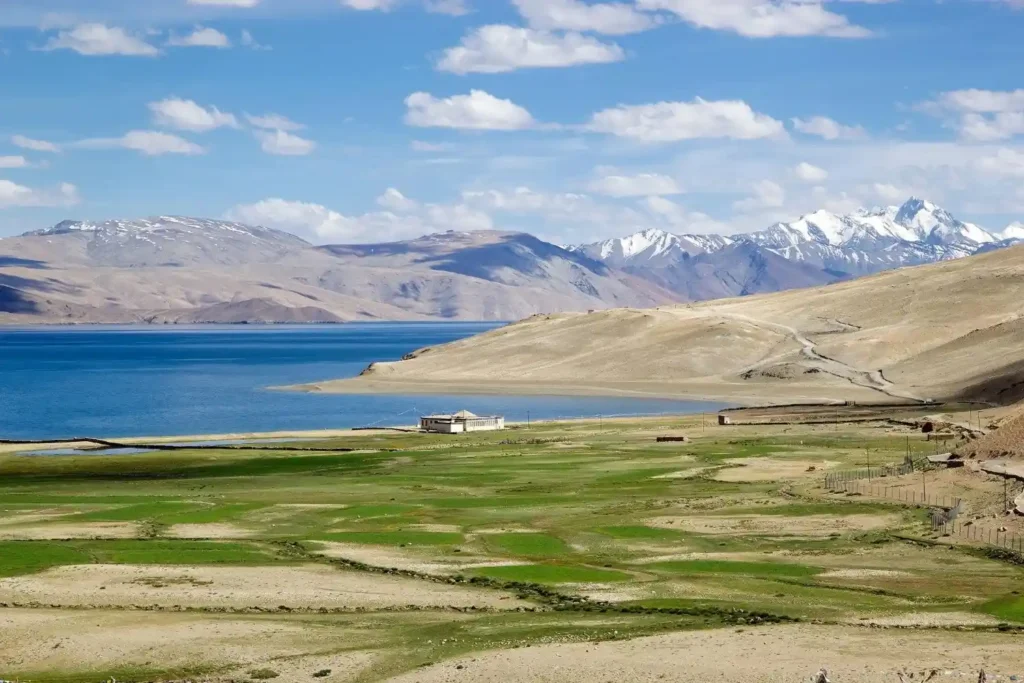
Tso Moriri is at 4,522 metres in the Changthang region of eastern Ladakh and is one of the finest high-altitude lakes in the country. The lake covers 120 square kilometres and is surrounded by an amphitheatre of brown-red mountains and flat grassland. It is a Ramsar-designated wetland and is protected under the Tso Moriri Wetland Conservation Reserve. The lake is significantly quieter than Pangong most standard Ladakh tour packages do not include it, which means visitors encounter far fewer tourists.
The birdlife here is exceptional: black-necked crane, bar-headed goose, Brahminy duck, ruddy shelduck, and several other high-altitude species are common. The grassland around the lake has Tibetan wild ass (kiang), Tibetan gazelle, wolves, and occasionally snow leopard. The drive from Leh takes about 5 to 6 hours via the More Plains plateau.
| Detail | Information |
| Location | Changthang region, 220 km from Leh |
| Altitude | 4,522 metres |
| Area | 120 sq km |
| Entry Fee | ₹50 per person (conservation reserve fee) |
| Timings | Open all day |
| Best Time to Visit | June to September; July-August for birdlife |
| Temperature Range | -30°C to 15°C |
| How to Reach | Road from Leh via Chumathang or More Plains (5–6 hours); Inner Line Permit required |
| Best For | Wildlife watchers, bird enthusiasts, photographers, solo travellers |
Travel Tip: Stay overnight at Korzok village on the lakeside. The evening light on the mountains and the morning mist over the lake are experiences that a day visit cannot provide. Basic guesthouses are available in Korzok.
Safety Tip: The road to Tso Moriri passes through areas above 4,500 metres. Do not drive this route until you have fully acclimatised in Leh for at least two days.
10. Alchi Monastery
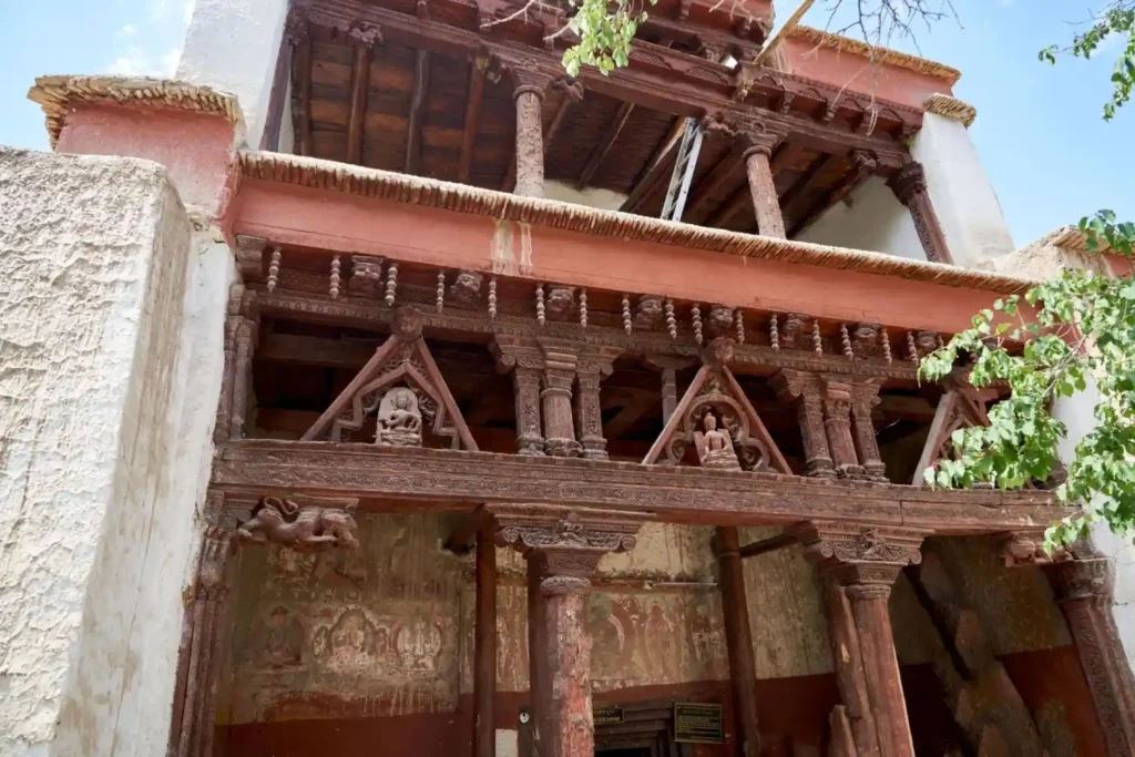
Alchi is one of the oldest surviving Buddhist monastery complexes in Ladakh, founded in the 10th or 11th century by Lochen Rinchen Zangpo the same figure who established Tabo in Spiti. Unlike most Ladakh monasteries which sit on high clifftops, Alchi is built in a flat valley beside the Indus River, about 70 kilometres west of Leh. This lower, sheltered location has protected its interior murals and stucco sculptures from the extreme weathering that has damaged many other sites.
The paintings at Alchi represent a style of Buddhist art that art historians describe as the finest example of Kashmiri-influenced Tibetan Buddhist art in existence. The small complex with its five main temples is compact enough to walk through in an hour, but the detail inside each structure is extraordinary. Alchi is often combined with Likir Monastery and Basgo Monastery in a single western-direction day trip from Leh.
| Detail | Information |
| Location | Alchi village, 70 km from Leh on Leh-Srinagar highway |
| Altitude | 3,100 metres |
| Entry Fee | ₹50 per person |
| Timings | 8:00 AM to 1:00 PM and 2:00 PM to 6:00 PM |
| Best Time to Visit | May to October |
| Temperature Range | -12°C to 30°C |
| How to Reach | Shared taxi from Leh or hired vehicle (1.5 hours) |
| Best For | History buffs, Buddhist art enthusiasts, solo travellers, cultural travellers |
Travel Tip: Photography inside the temples is generally restricted to protect the ancient murals from flash damage. The exterior of the complex and the surrounding village are freely photographable.
Safety Tip: The Alchi site is maintained by local monks. Respect all requests from the custodians regarding shoes off, no flash, and quiet behaviour inside the temple rooms.
11. Lamayuru Monastery and Moonland
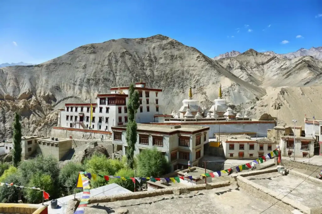
Lamayuru Monastery, 127 kilometres west of Leh on the Srinagar highway, is widely considered the oldest monastery in Ladakh; some sources trace its establishment to the 10th century, though the current buildings were largely built in the 16th century. The monastery is home to over 150 monks and belongs to the Drikung Kagyu lineage of Tibetan Buddhism. The surrounding landscape is what makes Lamayuru genuinely unusual; the area is known as Moonland or Lungyam because the eroded clay and sandstone formations around the monastery look like nothing so much as the surface of the moon: ridged, beige-grey, deeply furrowed. The combination of the ancient monastery and the lunar landscape creates one of the most photographically distinctive settings in all of Ladakh. Lamayuru is also the starting point for the classic Lamayuru to Alchi trek.
| Detail | Information |
| Location | 127 km from Leh on the Srinagar-Leh highway |
| Altitude | 3,510 metres |
| Entry Fee | ₹50 per person |
| Timings | 7:00 AM to 5:00 PM |
| Best Time to Visit | June to October; Yuru Kabgyat festival (July, lunar calendar) |
| Temperature Range | -15°C to 25°C |
| How to Reach | Road from Leh (3 hours); buses and shared taxis run on this route |
| Best For | Photography enthusiasts, history buffs, trekkers, cultural travellers |
Travel Tip: The best view of Lamayuru Monastery and the Moonland landscape together is from the viewpoint on the hill immediately opposite the monastery. Walk up the small hill across the main road for this angle.
Safety Tip: The Moonland formations look stable but the eroded clay is loose. Stay on established paths and do not climb the formations the material gives way suddenly and falls can cause serious injury.
12. Diskit Monastery and Hunder Sand Dunes
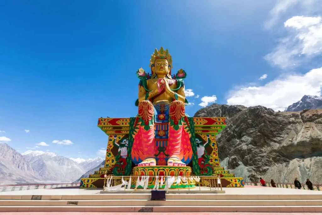
Diskit Monastery is the oldest and largest monastery in Nubra Valley, founded in the 14th century by Changzem Tserab Zangpo. The monastery sits on a hilltop with the Nubra Valley spreading out below it and a 32-metre-tall Maitreya Buddha statue added to the complex in 2010, visible from several kilometres away. The statue was consecrated by the Dalai Lama and faces down the valley toward Pakistan, a position that has symbolic significance.
Below Diskit, about 7 kilometres down the valley, the Hunder sand dunes run alongside the Shyok River. The dunes are a geological anomaly of cold desert sand at 3,100 metres surrounded by Himalayan peaks and the double-humped Bactrian camels that live and work here are a direct remnant of the Silk Route camel trade that once connected Ladakh with Central Asia.
| Detail | Information |
| Location | Diskit town and Hunder village, Nubra Valley |
| Altitude | 3,100 metres |
| Diskit Monastery Entry | ₹30 per person |
| Camel Ride Cost | ₹300–₹600 per person (approximately 20–30 minutes) |
| Timings | Monastery: 8:00 AM to 5:00 PM; Dunes: open all day |
| Best Time to Visit | June to September |
| Temperature Range | -20°C to 28°C |
| How to Reach | 120 km from Leh via Khardung La; Hunder is 7 km from Diskit |
| Best For | Families, couples, photographers, all travellers |
Travel Tip: The Bactrian camel ride at Hunder is best in the late afternoon when the light is golden and the shadows from the dunes create depth for photos. Early mornings before 8 AM are also good if you want to avoid queues.
Safety Tip: The camel handlers fix prices at the start. Agree on the cost and duration before mounting. The camels are generally gentle but do not approach them from behind without letting the handler control the animal first.
13. Zanskar Valley
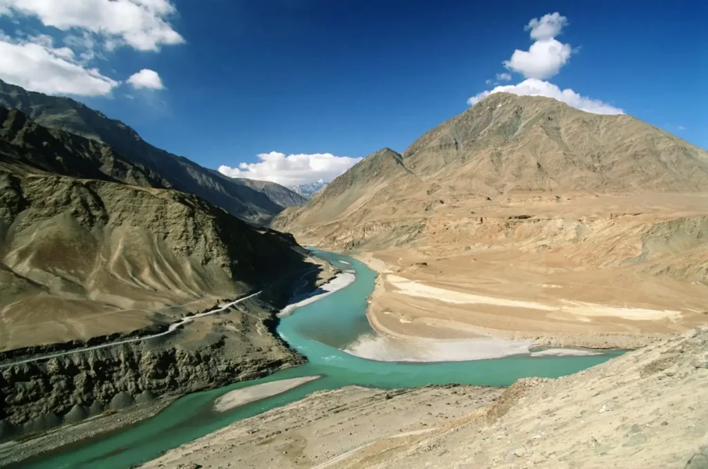
Zanskar is one of the most remote and least visited major valleys in Ladakh. The valley lies between the Great Himalayan Range and the Zanskar Range, and until recently was accessible only through high mountain passes that closed for six months each year. The main road into Zanskar from Kargil via Rangdum and Padum has been progressively improved and is now open from June through November. The valley is home to ancient monasteries including Karsha (the largest in Zanskar), Phugtal (a cliffside cave monastery accessible only by trek), and Zangla. The famous Chadar Trek a winter traverse of the frozen Zanskar River runs through this valley and has become one of the most challenging and celebrated treks in India. The river itself in summer is a major destination for white-water rafting through some of the deepest gorges in the Himalayas.
| Detail | Information |
| Location | South of Leh, accessed via Kargil (200 km from Leh to Kargil, then 240 km to Padum) |
| Altitude | 3,500 to 4,400 metres (valley floor) |
| Distance from Leh | 440 km to Padum via Kargil |
| Entry Fee | No entry fee for valley; individual monastery fees apply |
| Best Time to Visit | June to November (road access); January to February (Chadar Trek) |
| Temperature Range | -35°C to 22°C |
| How to Reach | Road from Leh via Kargil and Rangdum; Chadar Trek on foot in winter |
| Best For | Trekkers, adventure travellers, Buddhist culture enthusiasts, experienced travellers |
Travel Tip: Padum, the main town of Zanskar, has basic accommodation and serves as the base for all Zanskar exploration. Budget at least 3 to 4 days in the valley most travellers who go just for a day feel they barely scratched the surface.
Safety Tip: The Chadar Trek on the frozen Zanskar River is a serious undertaking, temperatures drop to -25°C or lower, the ice can crack, and the trek involves walking 10–15 kilometres per day on the frozen river surface. Only attempt with a professional agency and proper cold-weather gear.
14. Magnetic Hill
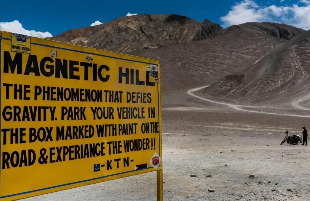
Magnetic Hill is a stretch of road on the Leh-Kargil-Srinagar highway, about 30 kilometres from Leh at 3,360 metres. The famous claim is that vehicles parked at a marked spot on the road and left in neutral will roll uphill. In reality, the effect is an optical illusion created by the specific angle of the road and surrounding landscape; the road appears to slope upward but actually slopes slightly downward. The surrounding hills create a visual context that makes downhill look like uphill.
Despite being an optical illusion, the effect is convincing and most people who try it come away genuinely puzzled. Magnetic Hill is almost always combined with a stop at the Sangam, the confluence of the Indus and Zanskar rivers a few kilometres further along the same road.
| Detail | Information |
| Location | 30 km from Leh on the Leh-Kargil highway |
| Altitude | 3,360 metres |
| Entry Fee | Free |
| Timings | Open all day |
| Best Time to Visit | June to October |
| Temperature Range | -15°C to 28°C |
| How to Reach | Road from Leh (40 minutes); most tours include it as a quick stop |
| Best For | All travellers; families, first-time Ladakh visitors |
Travel Tip: The effect is best appreciated in a car or jeep rather than a motorcycle. Put the vehicle in neutral, engage the handbrake, then release. The car appears to roll toward the uphill direction on its own.
Safety Tip: The Leh-Kargil highway is a busy two-way road. Do not park on the road itself or allow children to play on the road surface while testing the magnetic hill effect.
15. Gurudwara Pathar Sahib
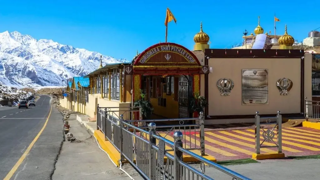
Gurudwara Pathar Sahib is on the Leh-Kargil highway, about 25 kilometres from Leh at 3,400 metres. The gurudwara was built in 1517 to mark the site where Guru Nanak Dev Ji is believed to have meditated and had a confrontation with a local demon. The central relic of the site is a large boulder with an imprint believed to be that of Guru Nanak.
The gurudwara is maintained and managed by the Indian Army. Free langar (community meal) is served to all visitors throughout the day and many travellers stop here for a hot meal and a quiet few minutes on the road between Leh and Nubra Valley or Magnetic Hill. The gurudwara is genuinely welcoming to all visitors regardless of religion.
| Detail | Information |
| Location | 25 km from Leh on the Leh-Kargil highway |
| Altitude | 3,400 metres |
| Entry Fee | Free |
| Langar Timings | 7:00 AM to 7:00 PM |
| Best Time to Visit | Throughout the year |
| Temperature Range | -15°C to 28°C |
| How to Reach | Road from Leh (30 minutes); most Nubra and Kargil routes pass here |
| Best For | All travellers; spiritual seekers, families |
Travel Tip: Cover your head before entering the gurudwara. Headscarves are available at the entrance. Remove shoes at the door and wash hands at the tap provided before entering the main hall.
Safety Tip: The gurudwara is adjacent to an active military zone. Photography of military installations nearby is not permitted. Respect all signage regarding restricted areas.
16. Chang La Pass
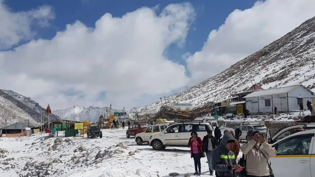
Chang La Pass at 5,360 metres is the third-highest motorable pass in the world and the main route between Leh and Pangong Lake. The road climbs from Leh through Sakti village and then rises steeply through a series of switchbacks to the pass. The top of Chang La has a small army post, a temple dedicated to Chang La Baba (a military officer whose spirit is said to protect travellers on the pass), and views of the Ladakh and Chang Chenmo ranges.
Almost every traveller heading to Pangong crosses Chang La, making it one of the most-visited passes in Ladakh. The army canteen at the top serves hot tea and soup.
| Detail | Information |
| Location | On the Leh-Pangong route, 40 km from Leh |
| Altitude | 5,360 metres |
| Entry Fee | Free; Pangong permit required |
| Open Season | Year-round, with occasional closures in heavy snow |
| Best Time to Visit | June to October |
| Temperature Range | -25°C to 5°C |
| How to Reach | Road from Leh via Sakti (1.5 hours to the pass) |
| Best For | Bikers, road trip travellers, Pangong visitors |
Travel Tip: Do not spend more than 15–20 minutes at the Chang La summit. At 5,360 metres, the thin air makes extended stops uncomfortable and potentially harmful for those not fully acclimatised.
Safety Tip: The descent from Chang La toward Pangong passes through a narrow gorge road with steep drops on one side. Drive at low speed and do not attempt overtaking in the narrow sections.
17. Tso Kar Lake
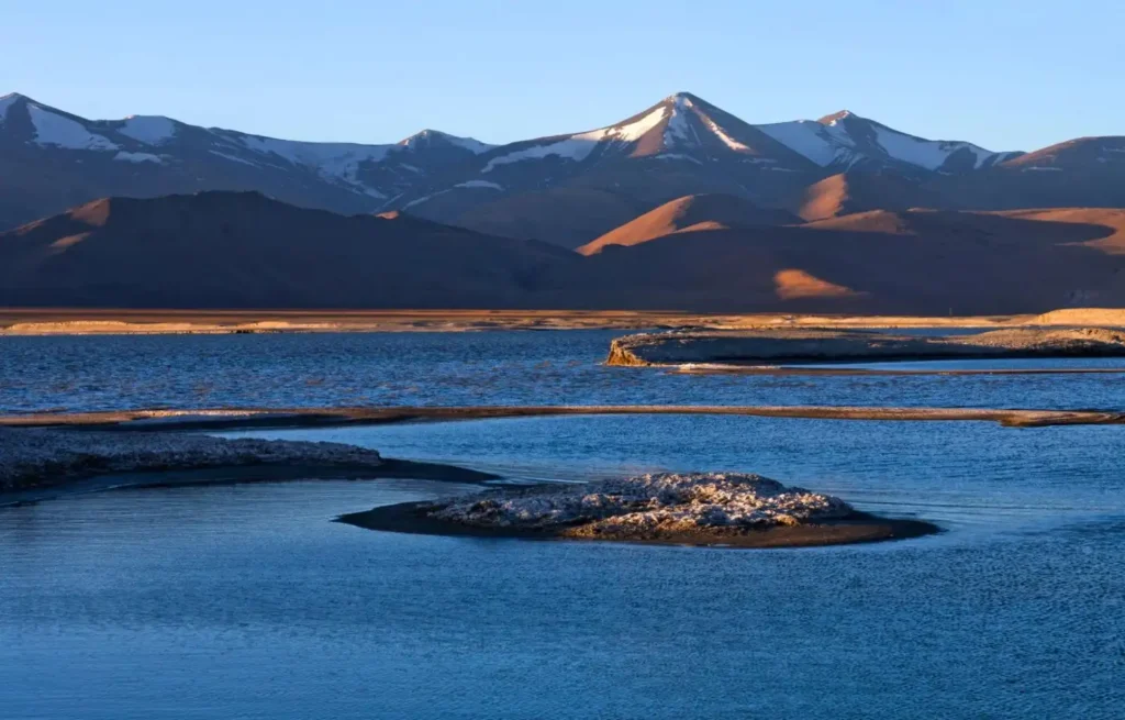
Tso Kar is at 4,530 metres in the Changthang region, roughly 150 kilometres from Leh between Leh and Tso Moriri. The name means “White Lake” and refers to the thick white salt deposits on its shores. The lake is a Ramsar-designated wetland and part of a complex of wetlands that includes a smaller nearby lake called Startsapuk Tso. Tso Kar is well-known for its birdlife; it is one of the key breeding grounds for the black-necked crane in India. Tibetan wild ass (kiang), Tibetan gazelle, and wolves are commonly seen on the plains surrounding the lake. Unlike Pangong and Tso Moriri, Tso Kar receives far fewer visitors and it is genuinely possible to have sections of the lakeshore completely to yourself.
| Detail | Information |
| Location | Changthang region, 150 km from Leh |
| Altitude | 4,530 metres |
| Area | 19 sq km (main lake) |
| Entry Fee | Included in Changthang area permit |
| Timings | Open all day |
| Best Time to Visit | June to September; July for black-necked crane breeding |
| Temperature Range | -30°C to 15°C |
| How to Reach | Road from Leh via Rumtse (4–5 hours); often combined with Tso Moriri circuit |
| Best For | Wildlife watchers, bird enthusiasts, photographers, experienced travellers |
Travel Tip: The Tso Kar–Tso Moriri loop, starting and ending in Leh, covers both lakes over 3 to 4 days and is one of the finest road circuits in Ladakh. The terrain between the two lakes is remote and exceptionally beautiful.
Safety Tip: There are very limited accommodation options between Tso Kar and Tso Moriri. Plan your route carefully, carry extra fuel (a jerrycan), and have food and water for at least one overnight emergency.
18. Hanle Village and Dark Sky Reserve
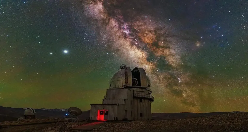
Hanle is a small village in the Changthang region at 4,360 metres, close to the India-China border. The Indian Astronomical Observatory at Hanle, operated by the Indian Institute of Astrophysics, has one of the world’s clearest and darkest skies; the site was chosen specifically because it has more than 250 clear nights per year and extremely low light pollution.
In 2022, the Ladakh administration formally designated the Hanle region as India’s first “Dark Sky Reserve,” covering approximately 1,000 square kilometres. Visitors can now access the stargazing facilities with advance permission and the experience of seeing the Milky Way from 4,360 metres on a clear winter night is extraordinary. Hanle also has an ancient monastery dating to the 17th century.
| Detail | Information |
| Location | Changthang region, 250 km from Leh near Tibet border |
| Altitude | 4,360 metres |
| Observatory Entry | Special permission required from Indian Institute of Astrophysics, Bangalore |
| Hanle Village | Free to visit |
| Timings | Village: open all day; Observatory: by appointment |
| Best Time to Visit | October to March for best stargazing; June–September for road access |
| Temperature Range | -35°C to 15°C |
| How to Reach | Road from Leh via Chumathang (5–6 hours); Inner Line Permit required |
| Best For | Astronomers, photographers, adventure travellers, solo explorers |
Travel Tip: The Hanle Dark Sky Reserve allows public stargazing in a designated area. Bring a tripod for astrophotography — the site has minimal light interference and conditions are extraordinary on cloudless nights.
Safety Tip: Hanle is close to the India-China border and requires an Inner Line Permit. Do not deviate from designated routes. Military checkpoints must be passed and all documents should be carried at all times.
19. Turtuk Village
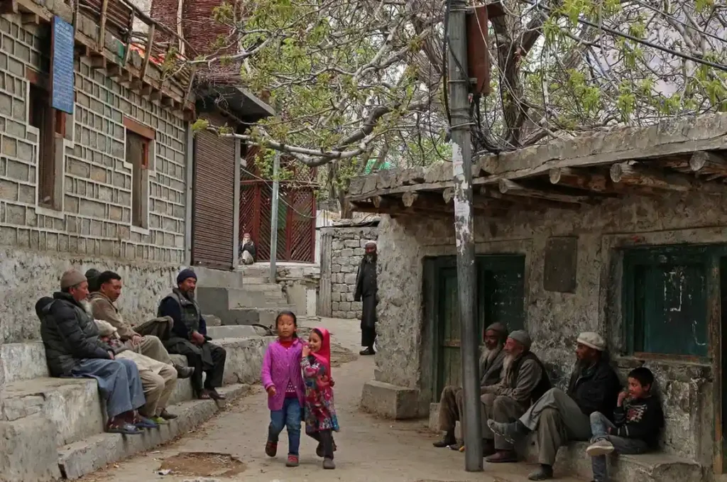
Turtuk is in the Nubra Valley’s Shyok River area, about 205 kilometres from Leh and just 10 kilometres from the Line of Control with Pakistan. The village was under Pakistani administration until 1971 when it came under Indian control following the Indo-Pakistani war. The population here is predominantly Balti ethnically and culturally distinct from the rest of Ladakh and their language, architecture, food, and customs are closer to Baltistan than to Tibetan-influenced Ladakh.
Turtuk has apricot orchards, terraced wheat fields, wooden houses with carved balconies, and a warm, genuine quality of local hospitality that many travellers describe as the most memorable human interaction of their Ladakh trip. The village was opened to Indian tourists in 2010 and to foreign tourists in 2014.
| Detail | Information |
| Location | Northern Nubra Valley, 205 km from Leh |
| Altitude | 2,900 metres |
| Entry Fee | No entry fee; Inner Line Permit required |
| Best Time to Visit | June to September (apricot harvest: late July to August) |
| Temperature Range | -15°C to 30°C |
| How to Reach | Road from Hunder via Shyok Valley (2.5 hours beyond Hunder) |
| Best For | Cultural travellers, photographers, history enthusiasts, solo travellers |
Travel Tip: Visit during the apricot harvest in late July or August. Local families dry apricots on their rooftops and will often share fresh fruit with visitors. The apricot-based food and oil of Turtuk is considered among the finest in the region.
Safety Tip: Foreign nationals require an ILP with Turtuk specifically listed. Get this in Leh before departure. The road beyond Hunder is not well-surfaced and requires a capable vehicle.
20. Dah Hanu Villages
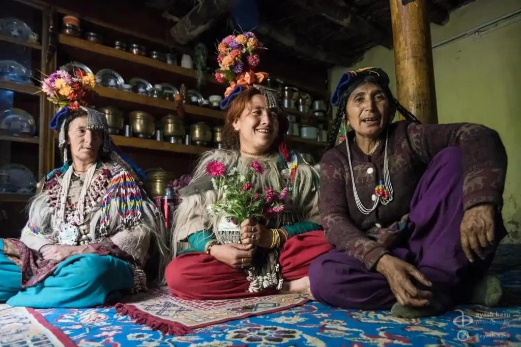
Dah and Hanu are villages along the Indus River, about 163 kilometres from Leh toward Srinagar, and are home to the Brokpa (also called Drokpa) community considered by many anthropologists to be one of the last communities in India with direct descent from the ancient Aryan populations that migrated through this region thousands of years ago.
The Brokpa have maintained distinct cultural practices, traditional dress (including elaborate floral headdresses worn by women), a separate language, and customs that differ markedly from both Tibetan-Buddhist and Muslim Ladakhi communities. The villages have apricot orchards, traditional stone homes, and a way of life that has changed far less than in more accessible parts of Ladakh. Access requires an Inner Line Permit and a road branching off the main Srinagar highway.
| Detail | Information |
| Location | Along the Indus River, 163 km from Leh toward Srinagar |
| Altitude | 2,900 to 3,100 metres |
| Entry Fee | No entry fee; Inner Line Permit required |
| Best Time to Visit | June to September |
| Temperature Range | -15°C to 30°C |
| How to Reach | Road from Leh via the Srinagar highway to Khalsi, then branch road |
| Best For | Cultural travellers, anthropology enthusiasts, photographers, solo explorers |
Travel Tip: Hire a local guide from the village to explain the Brokpa culture and traditions. The context provided by someone from the community transforms what could be a passing visit into a meaningful cultural exchange.
Safety Tip: Respect the community’s privacy. Ask permission before photographing people, particularly women in traditional dress. The Brokpa villages are not a performance; these are everyday lives being lived.
21. Umling La Pass
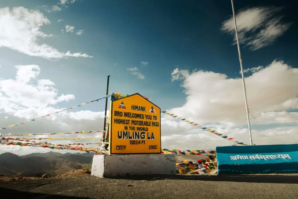
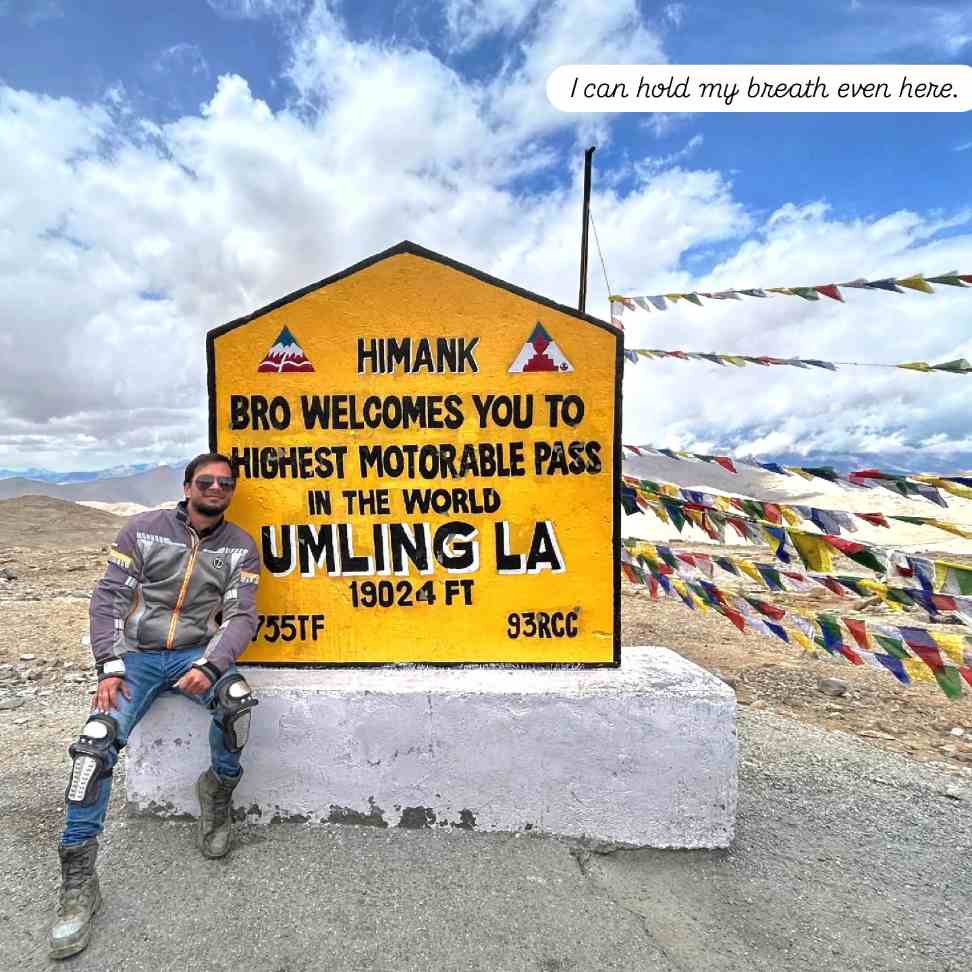
Umling La Pass opened in 2021 after construction by the Border Roads Organisation under Project Himank. At 5,883 metres above sea level, it is the highest motorable road in the world, surpassing Bolivia’s Uturuncu Volcano Road. The pass connects the villages of Chisumle and Demchok in the Changthang region of Ladakh, near the India-China border. The road is 86 kilometres long and passes through some of the most extreme high-altitude terrain in India.
Visiting Umling La is a significant physical undertaking even fully acclimatised travellers experience noticeable breathlessness at the summit. The drive is possible in a standard 4WD vehicle and has become a pilgrimage for bikers and adventure travellers seeking to ride the world’s highest motorable road.
| Detail | Information |
| Location | Changthang region, near Demchok, south of Leh |
| Altitude | 5,883 metres |
| Distance from Leh | 250 km (approximately) |
| Entry Fee | No fee; Inner Line Permit required; military checkpoint |
| Open Season | May to October (subject to weather) |
| Best Time to Visit | June to September |
| Temperature Range | -25°C to 5°C |
| How to Reach | Road from Leh via Chumathang; requires a capable 4WD vehicle |
| Best For | Adventure bikers, extreme road trip travellers, record chasers |
Travel Tip: Only attempt Umling La after at least 5 full days of acclimatisation in Ladakh at moderate altitude. At 5,883 metres, even fully acclimatised people may experience headaches and breathlessness at the summit.
Safety Tip: The road passes through a restricted area near the China border. Do not deviate from the designated route. All permits must be in order and presented at military checkpoints. Satellite phone rental is advisable for this route.
22. Kargil and Dras
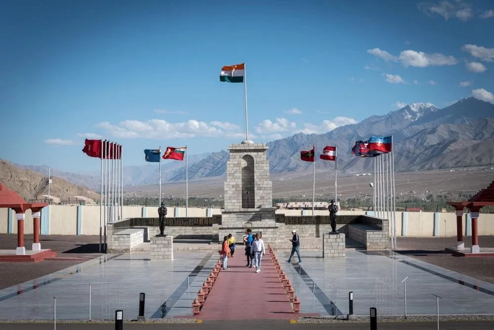
Kargil is the second-largest town in Ladakh and sits at the junction of the Srinagar and Leh highways on the Suru River. It is mostly Muslim in population and culture, unlike the Buddhist-majority areas further east, which gives it a distinct atmosphere, the call to prayer instead of monastery bells, different food, and different architecture. The town is primarily a stopping point for travellers on the Leh-Srinagar route. More significant historically is Dras, 60 kilometres west of Kargil, which is the site of the 1999 Kargil War.
The Kargil War Memorial at Dras honours the soldiers who died defending the peaks above the town against Pakistani incursion. The memorial has a wall of remembrance with all the names of the martyrs and a museum with photographs, equipment, and documents from the conflict. Dras also holds the record for being India’s coldest inhabited place.
| Detail | Information |
| Location | Kargil: 230 km from Leh; Dras: 290 km from Leh |
| Altitude | 2,676 m (Kargil); 3,280 m (Dras) |
| Kargil War Memorial Entry | ₹50 per person |
| Memorial Timings | 9:00 AM to 5:30 PM |
| Best Time to Visit | June to October |
| Temperature Range | -50°C (Dras in winter) to 30°C |
| How to Reach | Road from Leh (5 hours); road from Srinagar (4 hours) |
| Best For | History enthusiasts, patriotic travellers, Srinagar-Leh road trip travellers |
Travel Tip: Visit the Kargil War Memorial in the morning when the light is clearer. The peaks above Dras Tiger Hill, Tololing where the 1999 battles took place are visible from the memorial grounds.
Safety Tip: Dras holds temperatures as low as -50°C in January and is considered India’s coldest inhabited town. Winter travel here is only for travellers fully equipped for extreme cold.
Travel Tips for Ladakh
Altitude Safety: This is the single most important factor in a Ladakh trip. Spend two full rest days in Leh before going to any pass or lake above 4,000 metres. Drink 3 to 4 litres of water daily. Avoid alcohol for the first three days. Anyone experiencing severe headache, vomiting, or confusion must descend immediately.
Permits: Indian nationals need Inner Line Permits (ILP) for Nubra Valley, Pangong Lake, Tso Moriri, Hanle, Turtuk, and border areas. These can be obtained online at the Ladakh UT portal or at the DC Office in Leh. Foreign nationals need additional Protected Area Permits and should verify requirements before travel as regulations change periodically.
Cash: Carry adequate cash before leaving Leh. ATMs exist in Leh city and in Kargil. Beyond those towns, there are no reliable banking facilities. Most camps and smaller guesthouses do not accept cards.
Mobile Network: BSNL has the widest coverage across Ladakh. Airtel and Jio work in Leh city and a few larger settlements but lose coverage quickly outside town. Private and pre-paid numbers from outside Ladakh often do not work; this is a network restriction in the border zone. Buy a local BSNL SIM if your number is not already on that network.
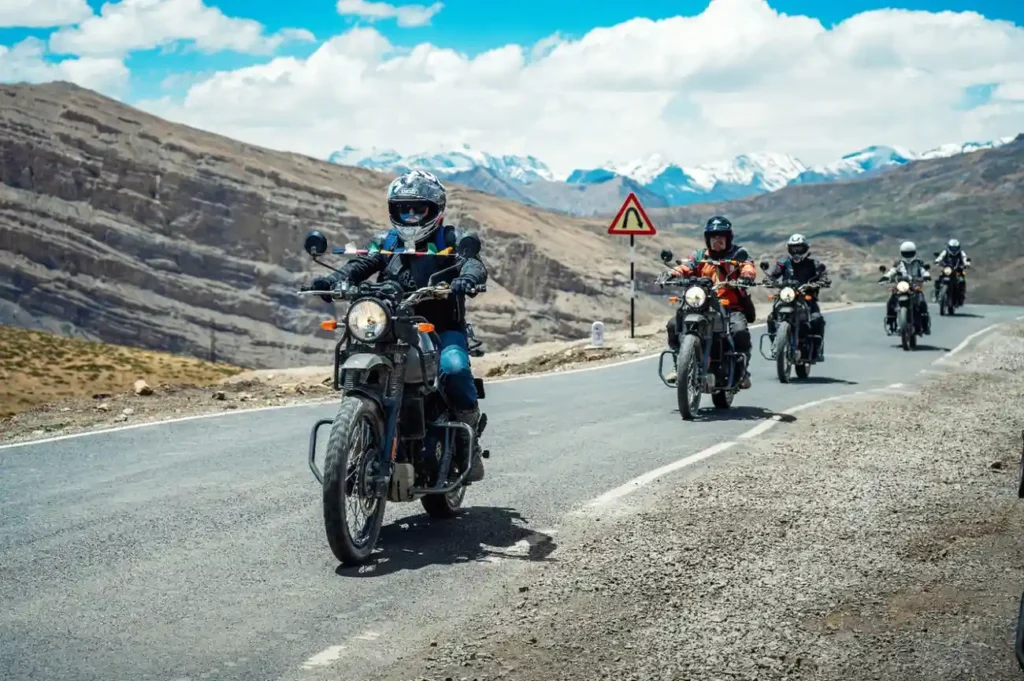
Vehicle: The most flexible way to explore Ladakh is with a hired vehicle and driver. Local drivers know the roads, passes, and checkpoints intimately. For bikers, Royal Enfield, KTM, and other motorcycles are available for hire in Leh. Carry a basic tool kit and tyre puncture kit for any route beyond Leh.
Clothing: Pack for cold regardless of season. Summer days in Leh reach 25°C but drop to 8–10°C at night. At passes and lakesides, temperatures can be near zero at any time of year. A down jacket, thermal base layers, gloves, and a windproof outer layer are essential year-round.
Food: Leh has excellent food options Tibetan thukpa, momos, Ladakhi butter tea, dal rice, and good cafes on Main Bazaar Road. Skyu (a thick pasta-like stew), tsampa, and chhang (barley beer) are local specialities. Outside Leh, camp kitchens serve simple vegetarian food. Carry dry snacks for long drive days.
Safety for Solo Travellers and Girls: Ladakh is considered one of the safest destinations in India. The local population is hospitable and crime is rare. Solo female travellers consistently report positive experiences. The risks here are environmental altitude, cold, and road conditions — not personal safety. Standard precautions apply: share your travel plans with your accommodation, carry a fully charged power bank, and avoid solo trekking in remote areas without a guide.
Conclusion
Ladakh does not fit into the standard categories that most Indian destinations fall into. It is not a beach destination, not a heritage trail, not a hill station, and not a pilgrimage in the conventional sense. It is a place that forces you to be present because the roads demand attention, the altitude demands patience, and the landscape demands that you actually look at it rather than look at your phone. Every traveller comes back with different memories because the experience is largely shaped by how slowly you move and how willing you are to talk to people and sit in silence.
If you are ready to plan a trip that gives you real space to think, Trip Guru Go can help you put together a complete Ladakh itinerary that fits your timeline, your physical condition, and the experience you are looking for. Go at least once. You will understand the rest once you are there.
FAQs
Is 6 days enough for Leh-Ladakh?
Six days is workable for a focused Ladakh trip but requires careful planning. A realistic 6-day itinerary would cover: Days 1–2 for Leh acclimatisation and city sights; Day 3 for Nubra Valley via Khardung La; Day 4 for Nubra to Pangong via Shyok Valley; Day 5 for Pangong; Day 6 return to Leh. This leaves out Tso Moriri, Zanskar, and most of the western circuit. 8 to 10 days gives a more balanced experience.
How many days are enough for Ladakh?
A minimum of 8 days is recommended for a first visit covering the main circuit (Leh, Nubra, Pangong, and acclimatisation days). For a fuller experience including Tso Moriri, Kargil, and some monastery exploration, 10 to 12 days is better. The altitude alone makes rushing counterproductive — cramming too many destinations into too few days increases health risks and reduces the quality of every stop.
What is the coolest place in Ladakh?
Dras, 60 kilometres west of Kargil, is India’s coldest inhabited town and records temperatures as low as -50°C in winter. For places that are cool and beautiful in the summer travel sense, Tso Moriri and Tso Kar are far less crowded than Pangong and offer a cooler, quieter experience. Hanle, Zanskar, and Turtuk are all considered offbeat and relatively undiscovered by mass tourism.
Which month does Ladakh have snowfall?
Significant snowfall in Ladakh begins in October in the higher areas and by November is common across most of the region. The main passes Khardung La, Chang La, Baralacha La, and Kunzum La — can receive snow from September onwards. Heavy snowfall in Leh city itself is less common but does occur in December and January. The Manali-Leh highway closes every year from October to May due to snowfall at the passes.
What is Ladakh famous for?
Ladakh is famous for Pangong Tso, Nubra Valley and the Bactrian camels, Khardung La Pass, Buddhist monasteries (Thiksey, Hemis, Alchi, Lamayuru), snow leopard sightings in Hemis National Park, the Chadar Trek on the frozen Zanskar River, motorcycle expeditions on some of the world’s highest motorable roads, and stargazing at the Hanle Dark Sky Reserve.
Is Ladakh safe for solo female travellers?
Yes. Ladakh is consistently rated among the safest destinations in India for solo female travellers. The local population, both Buddhist and Muslim, is known for hospitality and the crime rate is extremely low. The challenges in Ladakh are geographic altitude, weather, and road conditions. Standard precautions apply: inform your accommodation of your plans, carry a charged phone, avoid solo trekking in remote areas without a guide, and dress modestly near monasteries and religious sites.
What are the best offbeat places to visit in Ladakh?
The best offbeat places in Ladakh include Tso Kar Lake (far quieter than Pangong), Hanle village and Dark Sky Reserve, Dah Hanu Aryan villages, Turtuk and its Balti culture, Zanskar Valley and Phugtal Monastery, Umling La Pass (world’s highest motorable road), Puga Valley hot springs, and the village of Nyoma in southern Ladakh. All of these require either additional permits, extra driving time, or both — which is exactly why they remain genuinely uncrowded.
Do I need permits for Ladakh travel?
Indian nationals need Inner Line Permits for restricted areas including Nubra Valley, Pangong Lake, Tso Moriri, Hanle, Dah Hanu, Turtuk, and all areas near the borders with China and Pakistan. These permits are obtained online via the Ladakh UT portal or at the DC Office in Leh. Foreign nationals need Protected Area Permits for most border areas and should check the current requirements before travel as these rules change periodically. There is no permit requirement for Leh city, Thiksey, Hemis, Alchi, Lamayuru, or most of the main Srinagar-Leh highway.

Anjali is a travel content writer who creates informative and engaging articles about destinations, travel tips, itineraries, and travel experiences. She enjoys simplifying travel information to help readers plan their journeys with confidence while discovering new places and cultures.