Imagine starting your journey among pine-covered hills, colorful Himachali villages, and endless apple orchards. A few days later, you’re standing in a cold desert surrounded by barren mountains, ancient monasteries, and some of the highest villages in the world.
That’s exactly what makes the Shimla to Spiti Valley route special.
For many travelers, Spiti isn’t just another mountain destination. It’s a place where you disconnect from busy city life, spend nights under star-filled skies, meet locals in remote Himalayan villages, and experience landscapes that feel closer to Tibet than mainland India.
At TripGuruGo, this is the route we usually recommend when planning a Spiti itinerary because it allows travelers to experience the complete Himalayan transition from the lush valleys of Kinnaur to the rugged high-altitude desert of Spiti. For a broader overview of the region, check out our Spiti Valley Travel Guide.
Whether you’re planning a backpacking adventure, a bike trip, a road trip with friends, or your first Himalayan expedition, this guide covers everything you need to know about the Shimla to Spiti Valley route, including distances, travel times, major attractions, road conditions, accommodation options, and practical travel tips.
Why the Shimla Route is the Best Way to Enter Spiti Valley
Many first-time travelers search:
“Should I go to Spiti via Shimla or Manali?”
While both routes are beautiful, the Shimla route offers a more complete experience. If you’re starting your journey from Shimla, it’s worth spending a day exploring the town itself before heading out see our Shimla Tourism Guide for top attractions, places to stay, and things to do.
Gradual Acclimatization
One of the biggest challenges in Spiti Valley is altitude.
The Shimla route gradually takes you higher each day:
Shimla → Sangla → Kalpa → Nako → Tabo → Kaza
This allows your body to adapt naturally before reaching higher-altitude destinations like Key Monastery, Kibber, Langza, Hikkim, and Komic.
Experience Kinnaur Valley
Travelers entering through Manali miss some of Himachal Pradesh’s most beautiful destinations.
The Shimla route includes:
- Sangla Valley
- Chitkul
- Kalpa
- Nako
These places are destinations in their own right and often become unexpected highlights of the journey.
Shimla Route vs Manali Route — Quick Comparison
| Factor | Shimla → Kinnaur Route | Manali Route |
| Total Distance | ~730–760 km to Kaza | ~650–700 km to Kaza |
| Duration | 8–10 Days | 5–7 Days |
| Altitude Sickness Risk | Low (gradual gain) | High (rapid gain) |
| Kinnaur Covered | Yes — Sangla, Chitkul, Kalpa | No |
| Route Open | Most of the Year | Mid-June to Mid-October |
| Road Conditions | Better (NH-5 highway) | Rougher mountain roads |
| Best For | First-timers, Families, Couples | Bikers, Adventure Travelers |
| Chandratal Lake | Yes (at end via Manali exit) | Yes (during trip) |
One of India’s Most Scenic Road Trips
Few road trips in India offer such dramatic changes in scenery.
During the journey you’ll experience:
- Pine forests
- Apple orchards
- River valleys
- Cliff-side mountain roads
- Rocky canyons
- High-altitude deserts
- Snow-capped Himalayan peaks
Complete Shimla to Spiti Valley Route Overview
Shimla → Sangla → Chitkul → Kalpa → Nako → Tabo → Dhankar → Kaza → Key → Kibber → Chicham → Langza → Hikkim → Komic → Chandratal → Manali → shimla
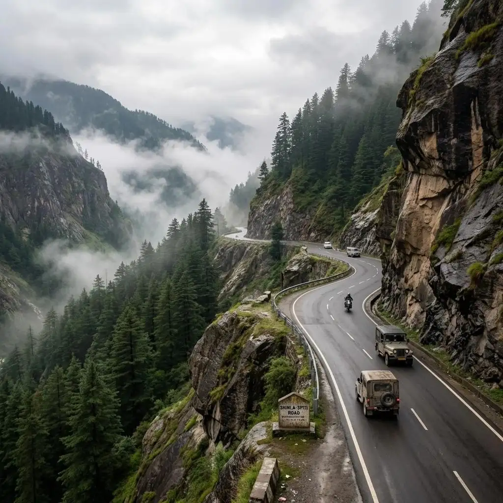
Stage 1: Shimla to Sangla / Chitkul — Into Kinnaur Valley
| Shimla → Sangla / Chitkul | |
| Distance | 215–230 km |
| Travel Time | 8–10 Hours |
| Highlights | Sutlej River gorge, Kinnaur Valley apple orchards, dramatic cliff-side roads, Chitkul — India’s last inhabited village near Indo-Tibet border |
| Recommended Stay | 1 Night in Sangla or Chitkul |
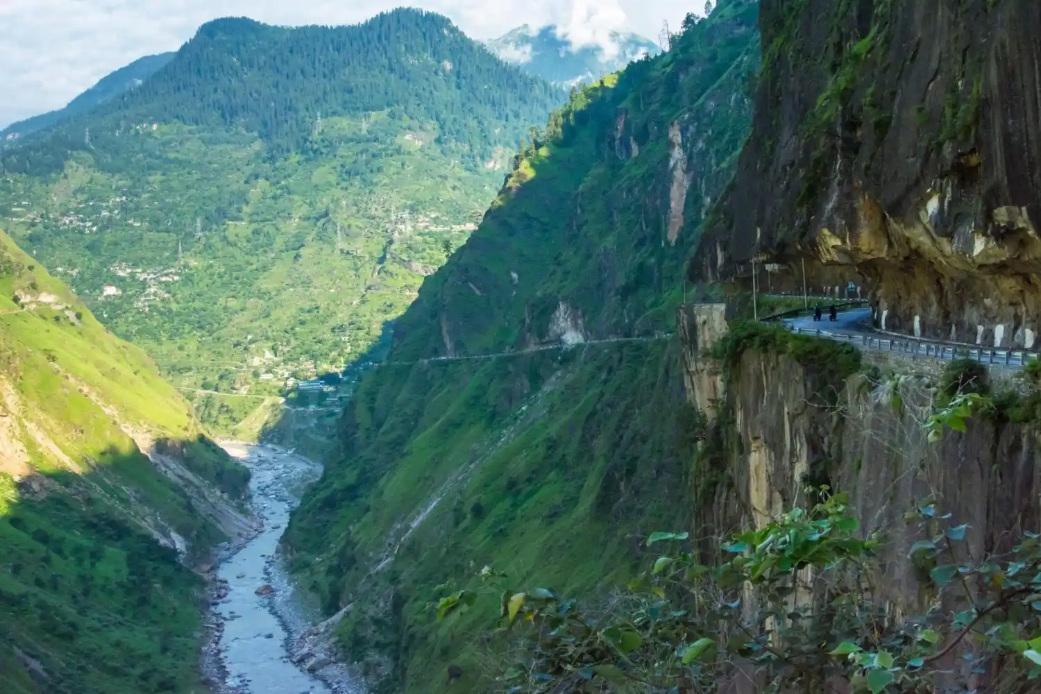
The adventure truly begins after Shimla.
As you leave the crowded hill station behind, the roads start following the Sutlej River through deep Himalayan valleys. Massive mountains tower above while the river carves its way through narrow gorges below.
Highlights Along the Way:
Narkanda
A small hill station known for forests, apple orchards, and mountain views.
Rampur
A historic town located on the banks of the Sutlej River.
Karcham
The point where roads split toward Sangla Valley and further into Spiti Valley.
Sangla Valley
One of Himachal Pradesh’s most beautiful valleys, famous for:
- Baspa River
- Snow-covered peaks
- Traditional wooden houses
- Apple orchards
Many travelers consider Sangla among the most scenic destinations of the entire trip.
Sangla to Chitkul India’s Last Village
Distance: 25 km
Travel Time: 1 Hour
Chitkul is often one of the most anticipated stops on the route.
Located close to the Indo-Tibet border, it is known as India’s last inhabited village.
What Makes Chitkul Special?
The village sits beside the Baspa River, surrounded by towering mountains and vast meadows.
Stage 2: Sangla / Chitkul to Kalpa
| Sangla / Chitkul → Kalpa | |
| Distance | 60–80 km |
| Travel Time | 2–3 Hours |
| Highlights | Kinnaur Kailash views, sprawling apple orchards, stunning sunrise and sunset over Himalayan peaks |
| Recommended Stay | 1 Night in Kalpa |
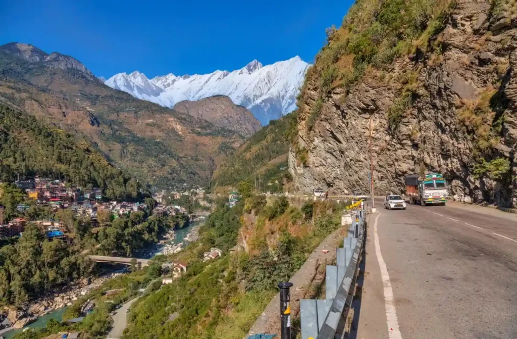
Kalpa is a small village perched at 2,960 metres with some of the most dramatic views of the Kinnaur Kailash peak (6,050 m). The short drive from Sangla makes this an easy addition with high scenic reward.
• Wake up early for sunrise views of Kinnaur Kailash worth setting an alarm for
• Walk through the apple orchards for fresh fruit during September October
• Reckong Peo (nearby) is the district headquarters good for permits and supplies
• Suicide Point viewpoint offers a dramatic view of the hanging road not for the faint-hearted
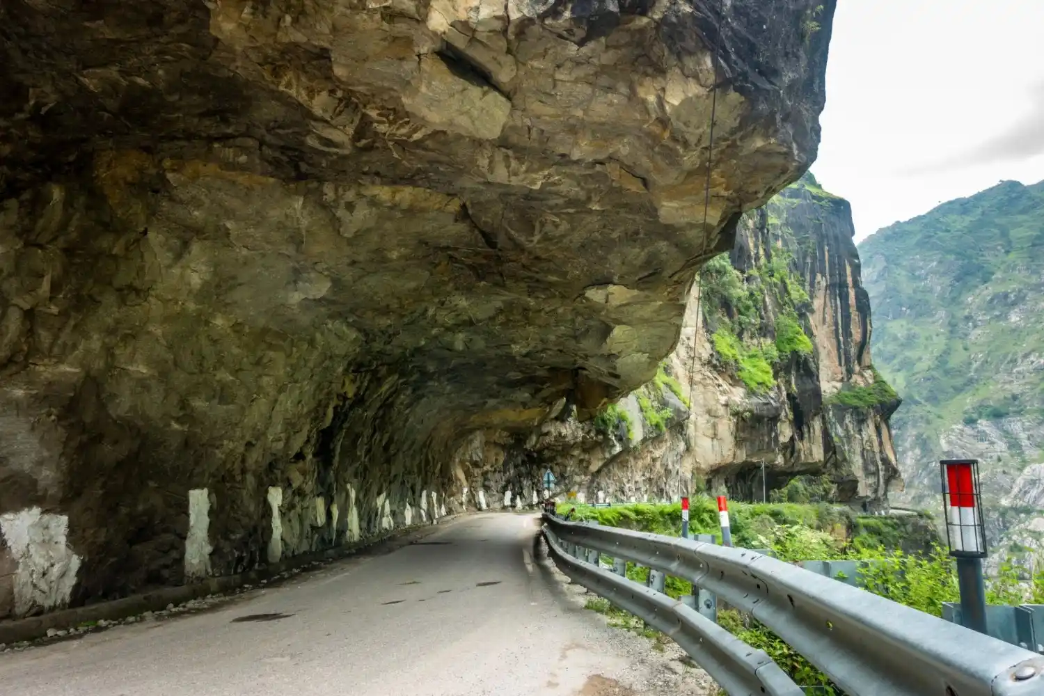
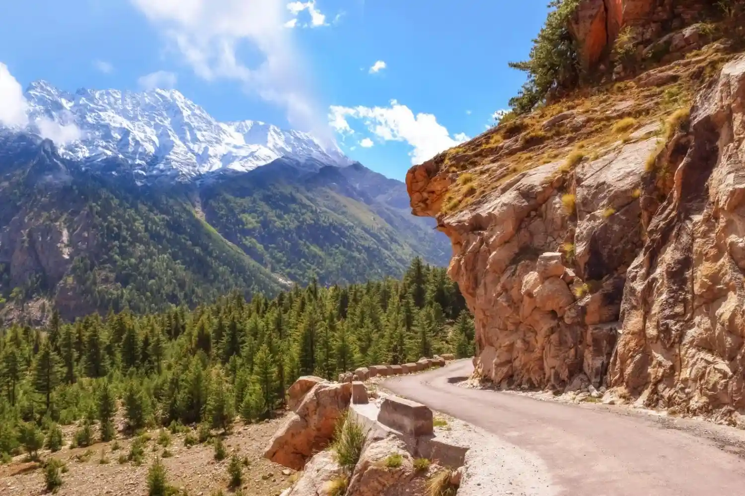
Stage 3: Kalpa to Nako — The Great Landscape Shift
| Kalpa → Nako | |
| Distance | 110–120 km |
| Travel Time | 4–5 Hours |
| Highlights | The landscape transitions from lush green Kinnaur to barren Tibetan-influenced terrain — one of India’s most dramatic road changes |
| Recommended Stay | 1 Night in Nako |
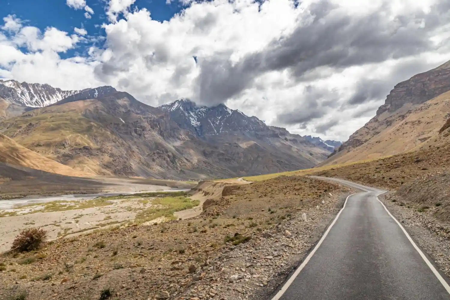
The green mountains of Kinnaur gradually disappear.
The forests become sparse.
The valleys become wider.
The mountains become rugged and barren.
This is where you begin entering the cold desert region that Spiti Valley is famous for.
Nako Lake
The center of the village is a beautiful high-altitude lake surrounded by mountains.
Nako Monastery
One of the oldest Buddhist monasteries in the region.
Why Stay Here?
Nako provides an excellent acclimatization stop before entering deeper parts of Spiti Valley.
Stage 4: Nako to Tabo — Monastery of the Thousand Buddhas
| Nako → Tabo | |
| Distance | 65–70 km |
| Travel Time | Around 2 Hours |
| Highlights | Tabo Monastery — 1,000-year-old Buddhist monastery, one of the oldest in the Himalayas. Mud-built temples with ancient murals and thangkas |
| Recommended Stay | 1 Night in Tabo (recommended) |
Tabo is one of the most significant Buddhist sites in the Himalayas. Founded in 996 CE, the Tabo Monastery complex predates most famous Tibetan monasteries and contains an extraordinary collection of ancient wall murals, stucco sculptures, and illuminated manuscripts.
• Spend at least 2–3 hours exploring the monastery complex
• The main temple murals are among the finest examples of Buddhist art in India
• Tabo is also considered sacred by the Dalai Lama many pilgrims visit
• Simple but comfortable homestays and guesthouses are available in the village
Stage 5: Tabo to Dhankar — Cliff Monastery with Valley Views
| Tabo → Dhankar | |
| Distance | 35–38 km |
| Travel Time | 1–1.5 Hours |
| Highlights | Dhankar Monastery perched on a cliff at 3,890 m, panoramic views of the Spiti and Pin river confluence, Dhankar Lake Trek (2 hours) |
| Recommended Stay | Half Day Stop or 1 Night |
Dhankar is an easy detour off the main Kaza road and is one of the most visually striking stops of the entire route. The ancient monastery balances on an eroded cliff above the confluence of the Spiti and Pin rivers.
• Dhankar Monastery is listed among the 100 most endangered heritage sites in the world
• Trek to Dhankar Lake (2–3 hours round trip) for one of the most rewarding short hikes in Spiti
• The viewpoint above the monastery offers one of the best panoramic views in the valley
• Most travelers stay overnight in Dhankar or continue directly to Kaza (35 km)
Stage 6: Dhankar to Kaza — Your Spiti Base
| Dhankar → Kaza | |
| Distance | 35–40 km |
| Travel Time | 1–1.5 Hours |
| Highlights | Kaza — the main town and district headquarters of Spiti Valley. Cafes, markets, guesthouses, and the hub for exploring nearby villages |
| Recommended Stay | 2–3 Nights in Kaza |
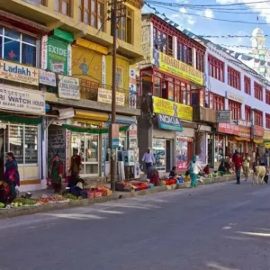
Kaza is the largest town in Spiti Valley and your base for exploring the famous high-altitude villages. At 3,800 metres, you will feel the altitude here, spend your first day resting and acclimatising.
• New Kaza has modern cafes, restaurants, and well-equipped guesthouses
• Old Kaza has traditional Spitian architecture and a small monastery
• The weekly market (Wednesday) is a great place to buy local produce and interact with locals
• Kaza is the starting point for all village excursions Key, Kibber, Langza, Hikkim, Komic
Places to Visit Around Kaza — Day Trips from Your Base
Once based in Kaza, the following are the key attractions all accessible as day trips:
| Place | Distance from Kaza | Altitude | What You See |
| Key Monastery | ~12 km | 4,166 m | Largest monastery in Spiti, hilltop fortress view |
| Kibber Village | ~18 km | 4,270 m | High altitude village, snow leopard habitat, wildlife |
| Chicham Bridge | ~32 km | ~4,300 m | One of Asia’s highest suspension bridges |
| Langza Village | ~16 km | 4,450 m | Buddha statue, marine fossils, Himalayan panorama |
| Hikkim Village | ~24 km | 4,440 m | World’s highest post office (officially verified) |
| Komic Village | ~25 km | 4,520 m | World’s highest motorable village, Tangud Monastery |
| Pin Valley NP | ~25 km from Kaza | ~3,800 m | Snow leopard, Himalayan wolf, red fox sightings |
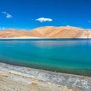
| Chandratal Lake | ~75 km from Kaza | 4,300 m | Crescent moon lake, camping, Milky Way views |
Shimla to Spiti Valley — Ready-to-Use 7-Day Itinerary
| Day 1 | Shimla → Sangla / Chitkul | 220 km / 8–10 hrs | Sangla or Chitkul |
| Day 2 | Chitkul → Kalpa | 60–80 km / 2–3 hrs | Kalpa |
| Day 3 | Kalpa → Nako | 110 km / 4–5 hrs | Nako |
| Day 4 | Nako → Tabo → Dhankar | 65 + 35 km / ~4 hrs | Dhankar |
| Day 5 | Dhankar → Kaza + Village Sightseeing | 35 km / 1.5 hrs + explore | Kaza |
| Day 6 | Kaza Villages: Key, Kibber, Langza, Hikkim, Komic, Chicham | Day trip (~120 km loop) | Kaza |
| Day 7 | Kaza → Chandratal → Manali (exit) or return | ~270 km / 8–10 hrs | Manali or transit |
Best Time to Travel the Shimla–Kinnaur–Spiti Route
| Month | Route Condition | Weather | Ideal For |
| March–April | Open (Kinnaur); Spiti may have snow | Cold, some snow | Early season, fewer crowds |
| May–June | Fully Open | Pleasant, warm days | Best overall — snow walls near passes |
| July–August | Open (some landslide risk) | Warm days, stable | Green valleys, full access to all sites |
| September | Fully Open | Clear skies, crisp air | Best photography, stable roads |
| October | Open (early closure risk) | Cold nights, autumn colors | Fewer crowds, dramatic landscapes |
| Nov–Feb | Spiti section closed / difficult; Kinnaur open | Heavy snow in Spiti | Kinnaur only — Spiti not recommended |
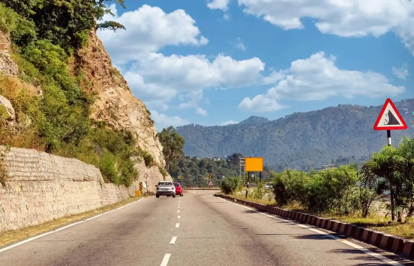
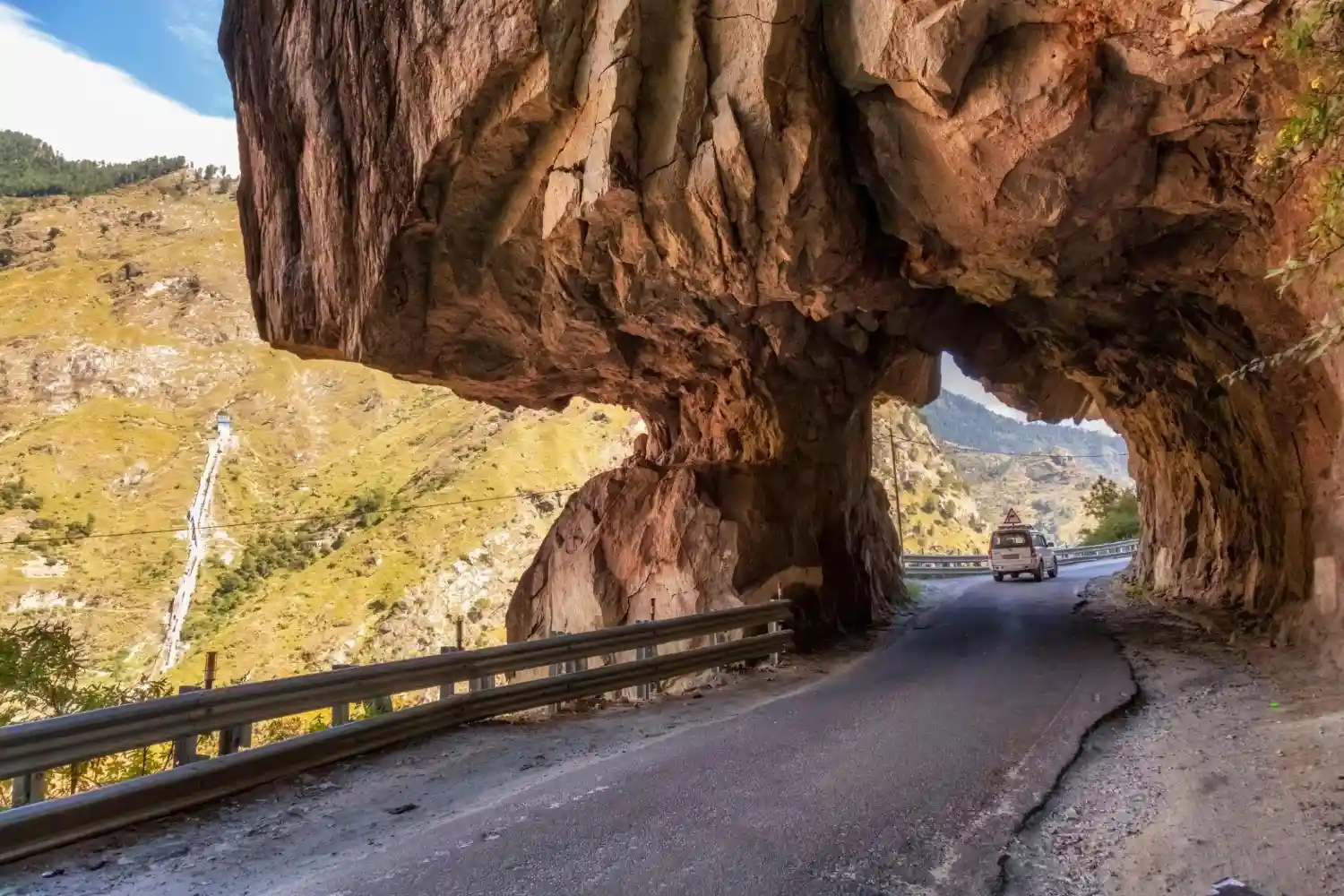
Road Conditions — Shimla to Kaza
Knowing what to expect on each stretch saves a lot of anxiety on travel day.
| Stretch | Road Quality | What to Expect |
| Shimla → Karcham | Good to Moderate | 2-lane mountain road, well-maintained |
| Karcham → Sangla | Moderate (narrow) | Cliff-side road, width for one vehicle in places |
| Sangla → Kalpa | Good | Well-maintained, scenic ascent |
| Kalpa → Nako | Moderate to Rough | Includes Malling Nalla — famous cliff-edge section |
| Nako → Tabo | Moderate | Spiti River valley road, some rough patches |
| Tabo → Dhankar → Kaza | Good | Paved road, smooth entry into Spiti’s main corridor |
Permits Required for Shimla–Kinnaur–Spiti Route
As of 2026, the following permit rules apply for the Kinnaur Spiti route:
• Indian nationals do not require an Inner Line Permit (ILP) for Spiti Valley itself
• For areas beyond Karcham toward the border regions, a Restricted Area Permit (RAP) may be required check current rules before departure
• Foreign nationals require an ILP for the Kinnaur region obtain this from the Sub-Divisional Magistrate office in Shimla or Reckong Peo
• Carry valid government ID (Aadhaar / Passport) throughout the journey there are multiple checkpoints
• If proceeding toward Chitkul, carry IDs as it is close to the Indo-Tibet border
Essential Tips for the Shimla–Kinnaur–Spiti Route
Acclimatisation
• Do not rush through stages altitude sickness can be serious above 3,500 m
• Spend at least 1 night each in Sangla/Chitkul, Kalpa, and Nako before entering Spiti
• Drink 3–4 litres of water daily and avoid alcohol in the first 2–3 days
• Carry Diamox (consult a doctor before use) and basic altitude sickness medication
Vehicle & Fuel
• A 4×4 or high-clearance vehicle is strongly recommended beyond Nako
• Last reliable petrol pump: Pooh (before Nako) fuel up here
• Carry a spare tyre roads beyond Karcham can damage tyres
• For bikers: Royal Enfield 350/500 cc is the most commonly used bike on this route
Connectivity & Cash
• BSNL SIM works in most areas Airtel/Jio may have signal in Kaza and larger villages
• ATM available in Kaza withdraw enough cash in Shimla or Reckong Peo before entering Spiti
• Most small dhabas and homestays in Spiti are cash-only
Health & Safety
• Nearest hospital: Reckong Peo (for Kinnaur) and Kaza Community Health Centre (for Spiti)
• Carry a basic first aid kit with ORS, painkillers, bandages, and cold medicine
• Weather can change rapidly always keep rain gear and extra warm layers accessible
• Download offline Google Maps for the Kinnaur Spiti route before starting
What Makes the Shimla–Kinnaur Route Special
Unlike the Manali route which drops you into Spiti with minimal transition, the Kinnaur route gives you a complete Himalayan journey. You witness one of India’s most dramatic landscape shifts from the green, apple-orchard-covered hills of Kinnaur to the barren, moonscape terrain of Spiti unfolding gradually over 8 days.
Travelers who take this route consistently describe it not just as a trip to Spiti Valley, but as one of the most memorable road journeys of their lives.
Related Guides
• Complete Spiti Valley Travel Guide 2026
• How to Reach Spiti Valley from Delhi All Transport Options
• Best Time to Visit Spiti Valley Month by Month Guide
• Places to Visit in Spiti Valley 15 Best Spots
• Chandratal Lake Complete Guide
• Spiti Valley Budget Guide What a Trip Really Costs
FAQ
Is the Shimla to Spiti route open all year?
The Kinnaur section (Shimla to Nako) is open for most of the year. The inner Spiti section (Nako to Kaza) may have limited access in January–February due to heavy snowfall, but is generally open from March onwards. This makes it significantly more accessible than the Manali route which is open only from mid-June to mid-October.
How many days does it take from Shimla to Kaza?
The direct drive from Shimla to Kaza without stops takes approximately 2 days. However, for acclimatisation and sightseeing — especially to cover Chitkul, Kalpa, Nako, and Tabo 5–6 days is the recommended minimum.
What is the hardest section of the Shimla–Kinnaur route?
The Malling Nalla section between Kalpa and Nako is widely considered the most challenging stretch. The road is carved into a vertical cliff face with narrow lanes, loose gravel, and occasional landslide risk. Drive slowly and avoid night driving through this section.
Can a regular car drive from Shimla to Spiti?
A regular hatchback or sedan can manage the Shimla to Kaza route during summer months (May–October) as the roads are generally paved. However, a high-clearance vehicle or 4×4 is strongly recommended for the sections beyond Nako. Post-monsoon road damage can affect drivability in certain years.
What are the must-see stops on the Shimla–Kinnaur–Spiti route?
Do not miss: Chitkul (India’s last inhabited border village), Kalpa sunrise over Kinnaur Kailash, Nako Lake, Tabo Monastery (1,000+ years old), Dhankar Monastery viewpoint, Key Monastery near Kaza, Langza Village, and Chandratal Lake.
Is there a mobile network on the Shimla to Spiti route?
BSNL works reasonably well throughout the Kinnaur and Spiti region. Private operators like Airtel and Jio have spotty or no coverage beyond Reckong Peo until Kaza. Download offline maps and important information before leaving Shimla.

Abdullah Khan specializes in adventure travel across Spiti Valley and the high-altitude regions of Himachal Pradesh. He writes about road trips, bike expeditions, hidden villages, monasteries, and offbeat Himalayan experiences. His guides focus on route planning, acclimatization, travel safety, and the best experiences across Spiti Valley.